Barrie Bay – Park Trail

Barrie waterfront
Posted on July 14, 2023 / 741
Barrie Bay – Park Trail
Listing Types : Park Trail
Location : Central Ontario
Note : NEW Review
Total Trail Km : 9.4
Hiking trail % : 5
Park Path % : 85
Road % : 10
Rate Skill Levels : Easy
Terrain : paved, crushed gravel, water crossing, flat sections, gentle hills
Faclities : parking, food close by, toilet, outhouse, drinking water, change rooms, lodging, trailhead map, good signage, trails maintained, shelter
Trail Fee : Free

Length – 9.4 = 6.4 + 3 km (one way)

85% park path
5% hiking trail
10% road riding, detours

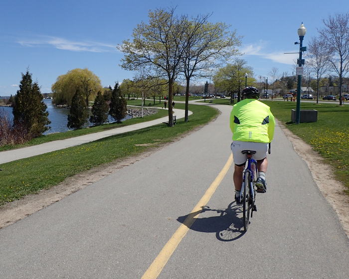
Elevation – Flat along water’s edge; short, easy climbs

Terrain – Paved path, RT is crushed stone, bridges, (wet) dirt path on extension

Skill – Easy

Maps – Map boards, trail markers, painted centre line

Traffic – Cyclists, rollerbladers, walkers (have separate paths half the time)

Facilities – Parking lot, toilets, benches, picnic tables, rain shelter, food & lodging nearby

Highlights – Views across the water, city vibe, downtown, beaches, train station

Trail Fee – Free

Phone – 705 726 4242

Website – City of Barrie,  Barrie by Bike

Similar Trails – Orillia waterfront (part of the Uhthoff RT),   Ajax Waterfront,   Hamilton Beach

Local Clubs – Barrie Cycling Club

Access – The good news is there is plenty of parking around the bay. The bad part is most of it is $10 an hour. The north end has a few lots that are cheaper. For free parking, your best strategy is to park away on a side street and ride to the waterfront.

Lennox Park
Minet’s Point Park
Southshore Centre
Centennial Beach
Heritage Park
Johnson Beach

The GO Train can take you from Toronto to Barrie’s Allandale waterfront, right where you need to be.


The ever-growing city of Barrie has developed a 6.4 km waterfront bike trail that’s fun to cruise on a hot summer day. This is a short ride around Kempenfelt Bay, on the west side of Lake Simcoe.

Unfortunately, Barrie has no other long off-road riding I can see, so I have added an optional extra 3 km to it heading south to make it a longer route.

My Barrie Bay route passes by parkland, beaches, a marina and continues onto a rail trail. Also, because it starts away from the beachfront, you may be able to find some free parking. The lots at the waterfront are very expensive ($10/hr).

My brother and I started from the south end at Lennox Park. The bike path going straight up to the bay was not well marked, a surprise considering this is part of the Trans Canada Trail. Nor was the terrain always easy to manage.

Willoughby Park was soggy going; you may wish to circumvent it by riding around the block instead. Granted, we rode it at the beginning of May, after a week of rain.

We had to use a map and you will, too, to get to the water as half of it was road riding. (There were some bike lanes.)

The paved waterfront path starts just west of Minet’s Point Rd and Lakeshore Dr, taking you into a woodlot where we were fortunate to see a giant woodpecker.

You will notice at this point the Allandale GO station stop, perfectly located for those who might take the train up from Toronto.

Soon enough you are out of the woods on to basic manicured parkland (I’d wish for more trees and flower beds). Large metal sculptures along the way may grab your attention. They’re not all art: the smaller ones are fitness workout stations that will give you more exercise than this short spin.

You’ll also find…

Read the rest of this review and 59 others in my NEW book, Volume 2 of Best Bicycle Park & Rail Trails in Ontario.

Vol 2 Bike Trail Book Ad

Barrie waterfront bike trail

Barrie waterfront bike trail

Reviews
3.4
Total Score 3 REVIEWS
Fun Factor: Scenic: Trail Design: Technical: Workout:
Leave a review
Fun Factor: Scenic: Trail Design: Technical: Workout: