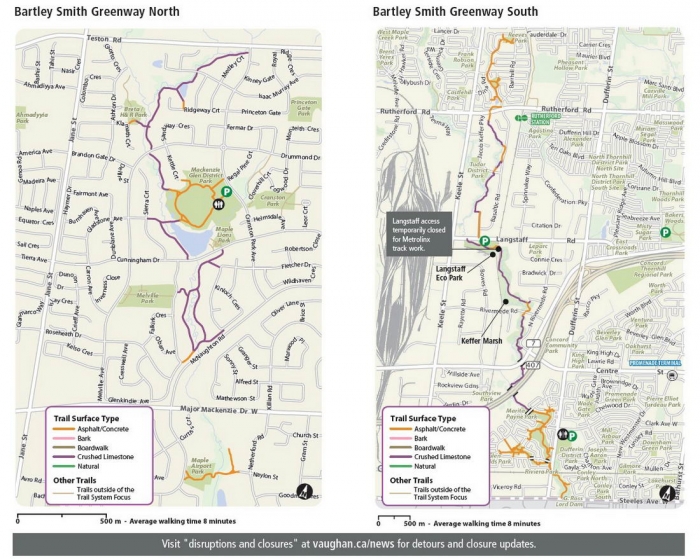
The Bartley Smith Greenway (BSG) is a 15 km park path in Vaughan, a suburb northwest of Toronto. This trail heads north following the source of the West Don River.
I recently revisited the route and found little changed except for new signage. It offers an enjoyable ride with a variety of open parkland and natural wooded scenery, and a few more hills than one would expect.
We started our day by parking in G. Ross Lord Park above the reservoir. I included this 2 km paved Hidden Trail to get you to Steeles Ave.; a busy road with few opportunities to park or breaks in traffic to cross. For safety, I recommend using the lights at the corner. The official start of the Bartley Greenway is on the other side of these six lanes.
Your other major crossing will be Dufferin St., where you can go under the train tracks and across another wide road at the lights. If you can spot it, there is a tunnel under Glen Shields Ave. which continues north on a concrete trailway to the pond, a lovely, tranquil setting to stop at (one of five along the way).
Once you are crossing under Hwy 407, the path turns to crushed limestone. Some call it stone dust, or is it limestone screening? Never a problem for most riders, just watch your turns, as there are pockets of loose grit.
The city has paved most of the sloping portions of the pathway with asphalt, a thoughtful addition, and added new signs which answer a lot of directional questions for cyclists.
Note as of June 2021: When you cross over Rivermede Rd., you will see that the city has a road detour notice posted, yet we saw a stream of local riders carry on. So we followed the natives to where the trail ends…sort of. There must have been a route through at one point, but now Metrolinx is making changes to the tracks, so the path has gotten cut off temporarily. Well, it’s unofficially still sort of open… as the fence has an opening and many before us have gone through.
So now you are at Langstaff Rd., an industrial area which is quiet on weekends. Head west, then north on…
Read the rest of this review in my NEW book, Volume 2 of Best Bicycle Park & Rail Trails in Ontario