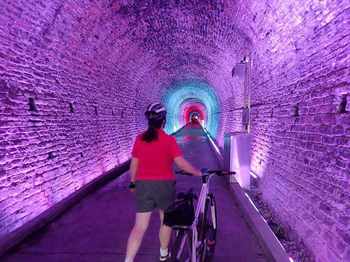
This one is an odd bike ride destination. The paved Park route through town has a train theme to it everywhere you look. Part Park ride, part train tunnel sound & light show.
Out on the shores of the St. Lawrence, Brockville has a long history as a hub for train travel and transport of goods.
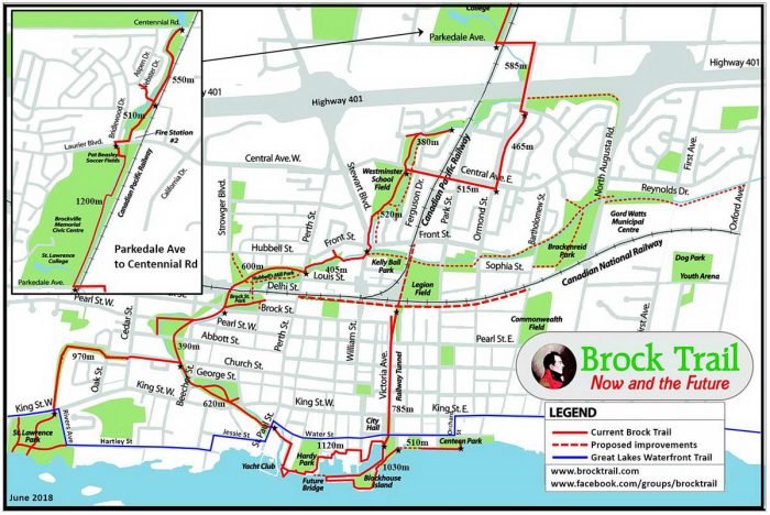
Traveling along hwy 401, I did a stop over there and scouted out a small park trail a mere 7 km long. Though pleasant, it was a tad short to list on this site. But then we found the tunnel!
This historic train tunnel runs under the centre of town. It’s a delightful, yet bizarre bit of Canadian history to stumble upon.
If you park by the south entrance you can ride first or walk the tunnel.
If you walk your bike through the tunnel to the north exit, there is a short stretch parallel to the mainline you can ride either way. CN has fenced off a trail laid with gravel behind building lots where you are assured to see train traffic.
Now back to the actual trail ride. The route to cycle is not well marked at the beginning and you are not supposed to ride the boardwalks. Though not obvious what the exact path is, I am sure you can figure it out.
So starting from the tunnel south entrance one can do the peninsula, Blockhouse Island, out and back to view the marina and USA across the river. This peninsula was made from the rubble taken from excavating the tunnel.
The main route heads west along the…
Read the rest of this review in my trail guidebook with better maps, parking suggestions & train history, when you buy the eBook or paperback.