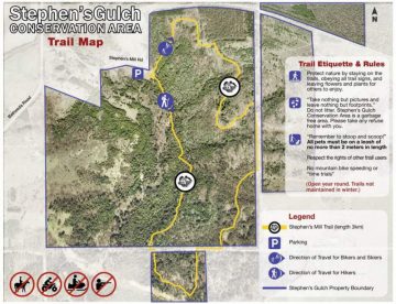
Stephen’s Gulch has a double track wooded Park trail with a few hills perfect for the rural Park cyclist or novice mountain bike rider out for a short try at trail riding. The trail is wide and easy to ride.
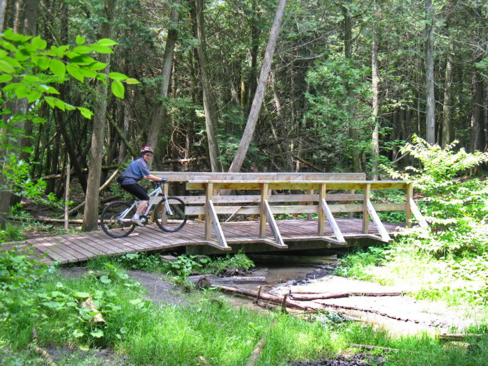
A few bridges make it interesting and so do a few scary downhills for newbies who will likely walk it.
Rated as an intermediate Park style ride that gets you riding loose soil (sandy) in a forest setting.
A short pleasant loop which is over in no time. Worth doing once.
I did see a tiny bit of single track but did not ride it. It may lead out of the park or loop back.
From the parking lot the trail goes north straight up a sandy hill that is not inviting unless you are on a Fatbike.
I walked it and you may want to ride this loop in the other direction.
After which the ride is a pleasant one in the woods. This is also a nordic ski trail in the winter.
Some sections are pure sand, not a fun ride or for the farmers years ago who tried to make something of the land and gave up. Better to have wide tires and for Fatbikes this place is perfect.
Consider riding it both ways to get 6km out of your outing.
Of all the rides reviewed on this site, this would be at the bottom of my “best of list”. And one day I may remove it. For now it serves to inform those who wonder what the riding is like there.
This one’s not in my book. But 65 other great destinations are with better maps, elevation graphs and more parking locations. Available as an eBook or paperback.