Length – 15 km
50% MTB single track
30% hiking trail
20% double track access roads
Elevation – a flat square forest tract with lots of small and medium climbs
Terrain – loam, sandy spots, some gravel, can be muddy, a few wide hiking paths with excellent twisty MTB trail, many log jumps and ramps
Skill – Easy to advanced
Traffic – Popular spot on weekend with MTB riders, and a few hikers and dog walkers.
Trail Pass – free
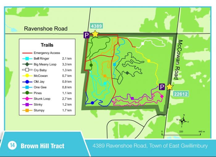
Facilities – limited parking, two lots
Highlights – So much twisty track in such a small area. Flowy trail and new boardwalks!
Maps – Map board at trailhead with well marked signposts on loops.
Phone – none
Website – York Region
Similar Trails – Dagmar, Albion Hills, Puslinch,
Local Clubs – Durham Mountain Bike Association
Trailhead – most riders enter where the map is on McCowan Rd. side and ride the loops clockwise, another entry point is on the northwest side
Directions – Hwy 404 north, exit Green Lane, east to Woodbine Ave, north 5 km to Ravenshoe Road, east 9 km to McCowan Rd., south 600 m, parking on the right.