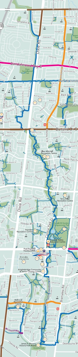
Length – 9 km (one way)
95 % park path
5 % road crossings, detours
Elevation – Flat with quick dips; climbs for road and water crossings.
Terrain – Wide paved path, with gravel patches, bridges and benched tunnels.
Skill – Easy
Maps – Limited amount of map boards, trail markers, bring your phone map app.
Traffic – Underused path with occasional cyclists, or walkers with dogs.
Facilities – Parking lot, toilets, snack bar, benches, picnic tables, rain shelter.
Highlights – Bridges, ponds, main park area.
Trail Fee – Free
Phone – 905 874 2000
Website – City of Brampton
Similar Trails – Upper Etobicoke Creek, Upper Humber River, Nokiidaa
Local Clubs – Brampton Cycling Club
Access – Large parking lots at these parks beside the path and many side streets have access paths:
- Ellen Mitchell Recreation Centre
- Balmoral Recreation Centre
- Victoria Park Arena
- Civic Centre
- Brampton Soccer Centre
- Donald Gordon Chinguacousy Park