Length – 39 km (one way)
90% rail trail path
10% road, detours
Elevation – A flat path with some slopes to the west and a large bridge to ride over Hwy 10.
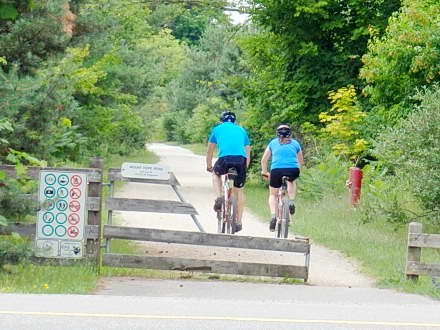
Terrain – Crushed, hard-packed limestone, with gravel, soil, and tall grass. The east end gets rather rough.
Skill – Easy
Maps – There are many directional and interpretive signs.
Traffic – Bicyclists and hikers, as well as the occasional horse and cross-country skiers in the winter.
Facilities – Services in most towns are listed, with picnic benches and portable toilets on the trail in Inglewood and Caledon East.
Highlights – The charming towns of Terra Cotta, Caledon East, Palgrave, and Tottenham.
Phone – None
Website – Town of Caledon
Similar Trails – Thorton Cookstown, Kissing Bridge, Oro Medonte
Local Clubs – Caledon Cycling Club
Access – There is parking for a few cars on side streets, as well as a large lot on Hwy 10 at the Ken Whillans Resource Management Area; the towns of Tottenham, Palgrave, and Caledon East are also good starting points.


